5 Difficult Level (3D 2N) Mountain Trips in Taiwan Worth Exploring
If you’re craving a challenging escape into Taiwan’s stunning high-altitude wilderness, these 3-day, 2-night (3D 2N) trips are perfect for pushing your limits. These aren’t beginner strolls—they’re for intermediate to advanced hikers with solid fitness, navigation skills, and gear prep. Expect steep ascents, rocky scrambles, and variable weather that can turn foggy or rainy fast. Always prioritize safety: train beforehand, pack essentials (rain gear, headlamp, first aid), and consider hiring a guide if you’re new to Taiwan’s mountains. Let’s dive in!
1. Wuling Sixiu (武陵四秀: Taoshan, Kalaye, Chiyoushan, Pintian)
Location: Shei-Pa National Park, Central Taiwan (spanning Taichung and surrounding areas), starting from Wuling Farm.
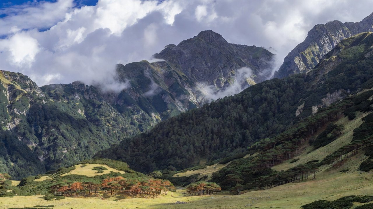
More Details about the Place: This loop traverses four of Taiwan’s Baiyue (Top 100 Peaks), featuring alpine meadows, pine forests, bamboo groves, and dramatic cliffs. Elevations range from about 2,000m to over 3,500m, with biodiversity including endemic birds like the Formosan blue magpie and rare flora. The area is part of a protected national park, offering glimpses of Snow Mountain on clear days and seasonal highlights like autumn maples or spring cherry blossoms.
Why It’s Appealing: It’s a “four-in-one” peak-bagging adventure with ridge walks that feel like a high-mountain vacation. Hikers rave about the hut-to-hut setup, stunning panoramas, and wildlife spotting—perfect for those seeking reflection amid Taiwan’s central ranges without extreme isolation.
The Route (3-Day Itinerary):
- Day 1: Start at Wuling Visitor Center (2,086m), cross the suspension bridge, ascend ~1,000m through forests and steep trails (8.7km, 7-10 hours). Optional side trip to Chiyoushan. Overnight at Xinda Cabin.
- Day 2: Early start to Pintianshan via bamboo and fixed-rope cliffs (6.6km out-and-back, 200m gain, ~9 hours). Traverse ridges, optional Chiyoushan revisit. Overnight at Taoshan Cabin.
- Day 3: Summit Taoshan for sunrise (short walk), out-and-back to Kalayeshan (~4-5 hours flat), then descend steeply to Wuling (11km, ~10 hours). Total: ~25km.
How to Go (With Tour Groups): Join guided tours from outfits like Taiwan Outdoors, which provide transport from Taipei (private van, ~3 hours), bilingual guides, insurance, and some meals. Book via their site or email; they handle logistics for 1-7 people. Other groups like Taiwan Adventures offer similar multi-day options—check Facebook groups for scheduled trips.
Permit Needed: Yes, competitive Shei-Pa National Park and police permits required. Apply 2 months to 10 days in advance via tour groups or online; not guaranteed, so book early.
2. Daba Jian Shan Group (大霸尖山群峰: Daba, Xiaoba, Yize, Jiali)
Location: Shei-Pa National Park, Northern Taiwan (Miaoli, Hsinchu, and Taichung counties), in the Xueshan Range.
More Details about the Place: This reserve covers 209 sq km with peaks up to 3,492m (Dabajianshan), glacial cirques, and diverse forests from alpine to temperate. It’s rich in indigenous Atayal history, with ancient artifacts and hunting paths. Vegetation includes endemic Yushan juniper and Taiwan fir, plus wildlife like Formosan black bears and macaques.
Why It’s Appealing: Iconic rock formations, panoramic ridges, and cultural significance make it a “century peak” must-do. The dramatic landscapes, including sunrise views and endangered species sightings, offer a mix of adventure and historical reflection in a cooler, snow-capped environment.
The Route (3-Day Itinerary):
- Day 1: From trailhead (after 19km forest road walk or transport), ascend through forests to Dabajianshan base (~10-12 hours). Camp overnight.
- Day 2: Steep rope-assisted climb to Xiaobajianshan summit, descend toward Yizeshan and Jialishan (full day traverse, ~10 hours). Camp.
- Day 3: Summit Yizeshan and Jialishan, enjoy views of the group, descend back (31km total loop, ~8-10 hours).
How to Go (With Tour Groups): Access via HSR to Miaoli, then bus to park HQ or rent a vehicle. Groups like Taiwan Outdoors or Imagine Taiwan offer guided 3-day treks with transport and expertise—enquire via email for private or scheduled groups. Note: Post-typhoon road closures may require extra planning.
Permit Needed: Yes, Shei-Pa National Park entry and police permits required for trails within boundaries. Apply online in advance; spots limited.
3. Bei Da Wu Shan (北大武山)
Location: Southern Taiwan, Pingtung County (near Kaohsiung), in the Central Mountain Range.
More Details about the Place: At 3,092m, it’s the tallest in southern Taiwan and a Baiyue peak. The trail features steep inclines, rocky boulders, ancient cypress forests, and landmarks like a 1,000-year-old cedar and an abandoned Japanese shrine. Weather varies from sunny to foggy, with unique southern flora and Paiwan indigenous ties.
Why It’s Appealing: Breathtaking cloud seas, sunrises from huts, and cultural history (e.g., WWII-era shrine) make it serene yet thrilling. Less crowded than northern peaks, it’s ideal for stargazing and immersing in southern Taiwan’s unique ecosystem.
The Route (3-Day Itinerary):
- Day 1: New Trailhead to Old Trailhead (2.5km, 1 hour), then to Kuigu Inn (4.2km, 3.5 hours, steep 2,000m gain). Sunset viewpoint short walk. Overnight at inn.
- Day 2: Night hike to summit (start 1am, pass cedar tree and shrine, ~4-5 hours to 3,092m). Rest at peak, descend to inn for lunch (~11km total).
- Day 3: Full descent from inn to trailhead (brutal downs, aim to finish before dark, ~8 hours). Total: 23km.
How to Go (With Tour Groups): Drive ~1 hour from Kaohsiung or join groups like Taiwan Adventures for guided southern hikes. Check Tripadvisor or Facebook for operators; they provide transport and lodging bookings.
Permit Needed: Yes, climbing permit from Taiwu Police Station (print and show at check-in). Book lodging in advance for entry.
4. Jiaming Lake (嘉明湖, with Xiangyang and Sancha Peaks)
Location: Taitung County, Eastern Taiwan, at 3,310m in the Central Range.
More Details about the Place: Known as “Angel’s Teardrop,” this high-altitude lake (6m deep, gem-blue) is Taiwan’s second-highest. Surrounded by ridges, it’s a Baiyue multi-peak area with juniper forests, meteor showers, and cloud seas. The trail involves elevation gains through varied terrain.
Why It’s Appealing: The ethereal lake, starry nights, and three summits (including two Baiyue) create a magical, challenging high-mountain experience. Sunrise over the lake is unforgettable.
The Route (3-Day Itinerary):
- Day 1: From Siangyang Trailhead, ascend to Xiangyang Hut (or campsite, ~600m gain then descent, 5-7 hours). Overnight in tent/hut.
- Day 2: To lake and Sancha Peak (900m gain, ~8 hours). Optional relax at lake. Overnight at shelter.
- Day 3: Summit Xiangyang Peak, descend (~1,300m loss, 6-8 hours). Total: ~20-25km.
How to Go (With Tour Groups): Groups like Orange Cat TTtrips or Taiwan Outdoors offer guided treks with transport from Chishang Station (~NT$7,500, includes insurance and gear). Book early; requires prior hiking experience.
Permit Needed: Yes, Yushan National Park entry and police permits. Tour groups handle applications; assess fitness required.
5. Axi Traverse (阿溪縱走, including Shuiyang Forest)
Location: Spanning Chiayi to Nantou (Alishan area to Zhushan), in the foothills of Jade Mountain.
More Details about the Place: This traverse features abandoned rail lines, misty lakes, and ancient trees like the 4,100-year-old Mianyue Shenmu. Shuiyang Forest, a post-earthquake barrier lake at 1,822m, has flooded trees creating a fantasy-like scene. Trails include steep slopes and scratchy vegetation.
Why It’s Appealing: “Fantasy forest” vibes with historical elements, starry campfires, and serene lake views. It’s a blend of nature and exploration, less extreme but with unique post-disaster beauty and peaceful mornings.
The Route (3-Day Itinerary):
- Day 1: Start from Alishan or Songluo, hike to Shuiyang Lake (10km, 6 hours, ups/downs). Camp by lake.
- Day 2: Explore forest, ridges, and ancient trees; optional loops (~8-10 hours traversing). Camp.
- Day 3: Return or exit via alternative paths (10km, 5-6 hours). Total: ~30km.
How to Go (With Tour Groups): Bus from Alishan to trailhead. Groups like Taiwan Adventures specialize in Alishan multi-days; enquire for camping setups. Independent but guided recommended due to “closed” signs.
Permit Needed: No formal permits, but note government “CLOSE” warnings—hike at own risk. Check park updates.
Remember, these hikes demand intermediate to high-level experience—don’t underestimate Taiwan’s terrain! For permits, use official sites like national park portals, and always check weather. For personalized planning or joining a group, head over to my Concierge Page where I curate custom Taiwan trips. Happy hiking!